Data Acquisition
Where did it come from?
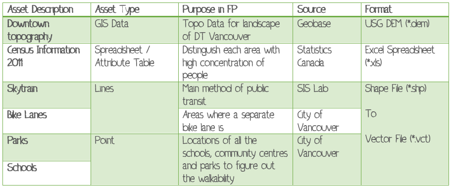
Data Preparation
ESRI ArcMap was used to read the raw file or the shape file (*shp). The DEM file from Geobase had no information or coordinates to it, therefore one must input the values and assign a coordinate system. I chose to use the UTM 10N.
IDRISI Conversion
Since the DEM cannot be opened in IDRISI, it must be converted in ASCII format in ArcMap. By using the conversion tool in ArcMap called Raster to ASCII. This file is now able to be opened in IDRISI and going to File > Import > Software Specific Files > ERDAS. Chose the DEM file and gave it an output name which computes and once the conversion is complete it is a raster file (*.rst).
Base Maps

This is the DEM of the Greater Vancouver Regional District after being converted into IDRISI. The Legend shows the elevation in metres.